

Suitability Analysis Background
Suitability Analysis allows you to qualify, compare, and rank candidate sites based on how closely they adhere to criteria that you select and define. Think of things like the ideal location of a wind farm based on prevailing wind direction, topography, land use, etc.
It is a comprehensive workflow and when done right requires the user to design and follow a strict methodology to be confident in their results. However, in some cases, you may need to perform a quick reconnaissance of an area using a limited number of variables.
Here we’ve detailed a very basic suitability analysis using only publicly available datasets and user-friendly tools. Unlike pre-designed tools like ArcGIS Pro’s Suitability Modeller which requires a Spatial Analyst license, this workflow will work in most GIS software packages with equivalent plug ins.
The Brief
For this example, the client is planning to build multiple new alpine huts in Victoria’s high country that are each a day’s hike from each other. To achieve this, they have isolated a 25 sq km project area where a single hut will be located (and subsequent huts in adjoining 25 sq km project areas). We’re going to look at just one project area.
Now the obvious issue here is choosing a location for the hut. This is where the suitability analysis comes in. When performing an analysis like this, you’ll have to either determine the variables using your knowledge of the theme or follow prescribed needs by the client. Luckily, our imaginary client has provided just that.
This hut needs to have the following spatial ingredients:
Elevation below 1000 to put it roughly below the snowline.
Within 200m of a water source.
Visible from roads.
North facing, as its going to be solar powered.
Slope less than or equal to 30 percent rise.
Looking at these requirements we’ll need a few data sources like a digital elevation model (DEM), hydrological layer showing streams and a transport layer shiwing roads. To keep things simple for this walkthrough, we’re going to access each one of these from ArcGIS Online, but if you are using a different application, equivalent layers are usually simple enough to find.
Preparing the data
1.Elevation below 1000 m
The Digital Elevation Model (DEM) doesn’t need any further processing as we’ll select out all cells over 1000m in the final processing.
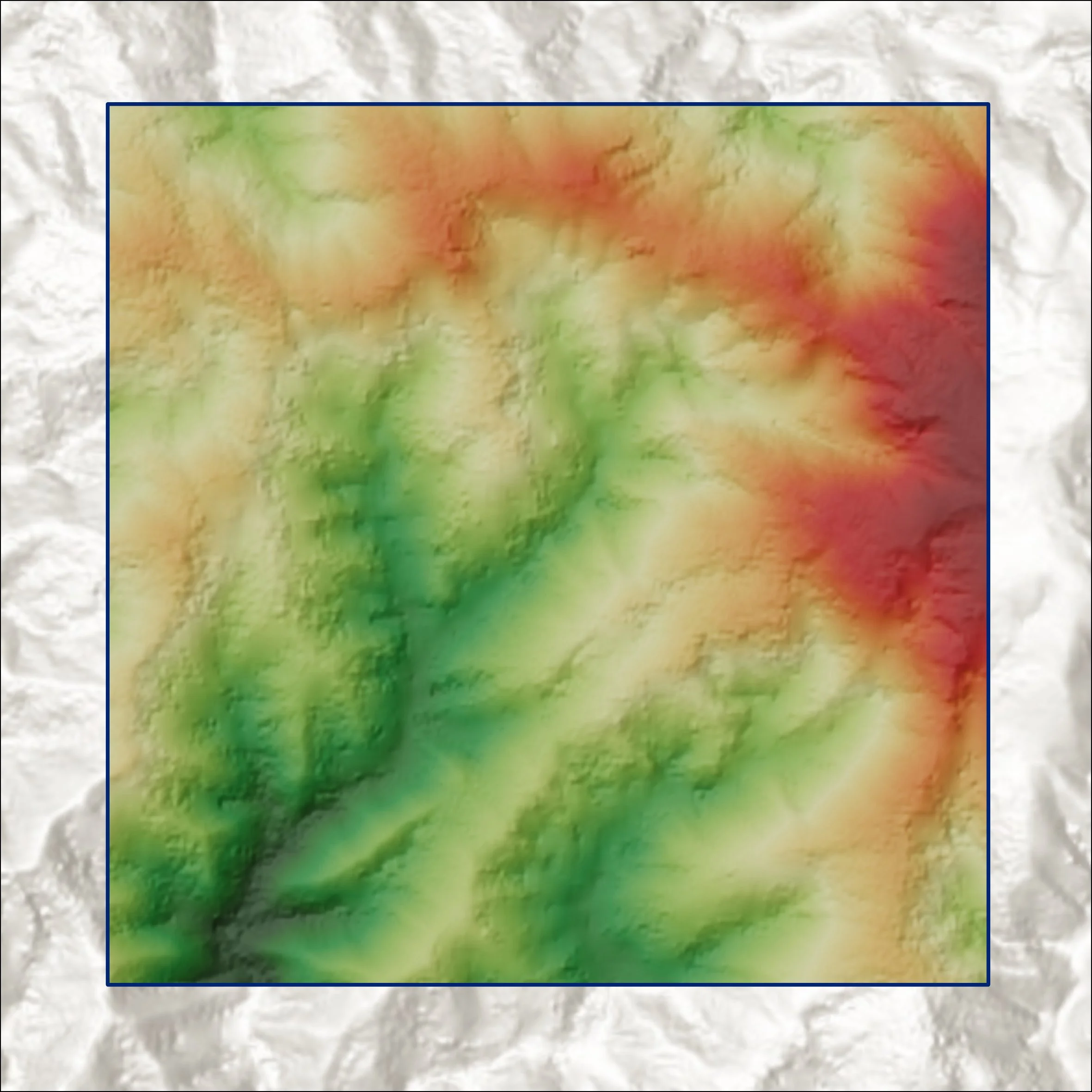
Digital Elevation Model (DEM).
2. Within 200 m of a water source
We need to determine the distance to streams. To do this, we run the Euclidean Distance tool in ArcGIS Pro on the streams.

Streams after running the euclidean distance tool.
3. Visibility from the road
Perform viewshed analysis using the road layer and DEM.

Visibility from the roads (Viewshed Analysis).
4. North facing
Run the aspect raster function on the DEM.

Aspect raster function run on the DEM.
5. Slope
Run the slope raster function and indicate percent rise as a parameter.

Slope raster function ran on the DEM.
Suitability Analysis - Processing
Now with the input layers complete, we’re ready to determine which areas meet our initial requirements. To do this, use the raster calculator.
For our example, the equation is:
("ELEVATION" <= 1000) & ("HYDRO" <= 200) & ("SLOPE" <= 30) & ("ASPECT" <= 67.5) & ("ASPECT" >= 292.5) & ( "VISIBILITY" != 0)It is likely that your layers and parameters will differ from those listed above, but you should be able to substitute those in to meet your needs.
Once this equation has run, the resulting output is a binary raster where all cells qualify every aspect of the above equation. If the area is too great or doesn’t meet your needs, we can simply adjust something and run it again.
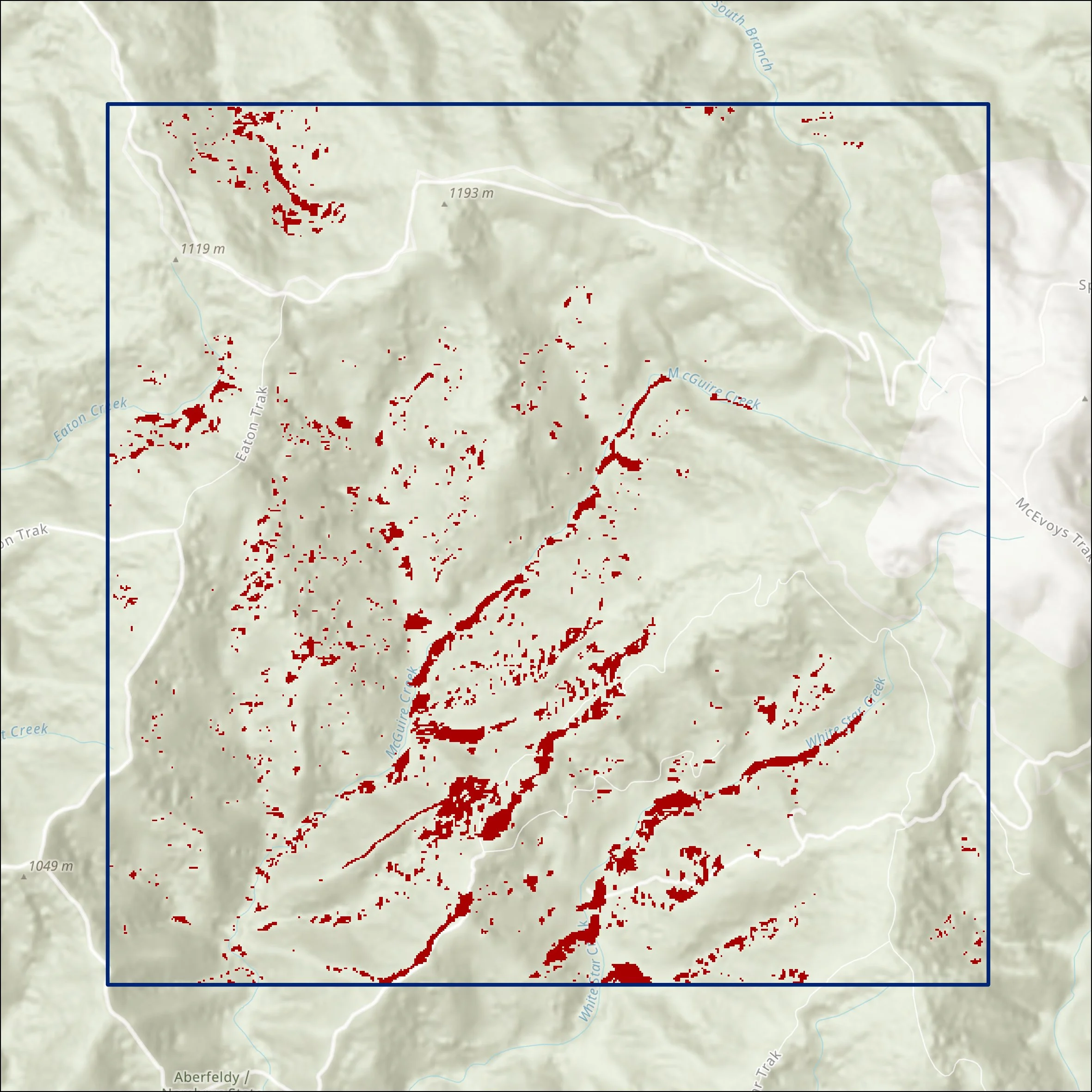
Locations that meet our project requirements from a rapid suitability analysis.
Using this simple calculation, we’ve reduced the area of interest from 1126.8 hectares to only 10.7 hectares. Our candidate site is somewhere in that 10.7 hectares and able to be field checked.
Suitability analysis can be tedious, but depending on your needs, can also be rapid. This workflow and the raster calculation above are a good alternative for a rapid suitability analysis. If you need help, refer to our consultancy services page or consider reaching out.