

Does your tourist destination or local council/municipality have great maps? Or are they bland as if they were taken from Google Maps? Are the maps flexible enough to be deployed in a range of formats? Below we make the case for having a cartographer prepare your maps.
Data and layers
Maps have layers, right? So does photoshop, so why not get a graphic designer? Cartographers use spatial files in their maps, and as data becomes outdated, it is easily updated by swapping in a new file. This is not as simple, if at all possible with graphic design software if it doesn’t use spatial layers. If you had a map showing the location of parking around your city and it went from 20 known locations to 200, you would be loading up your graphic designer with a massive, tedious task of plotting them with a significant risk of error. In GIS software, you can simply swap out the files from your database and bam, it’s updated.
Aesthetics
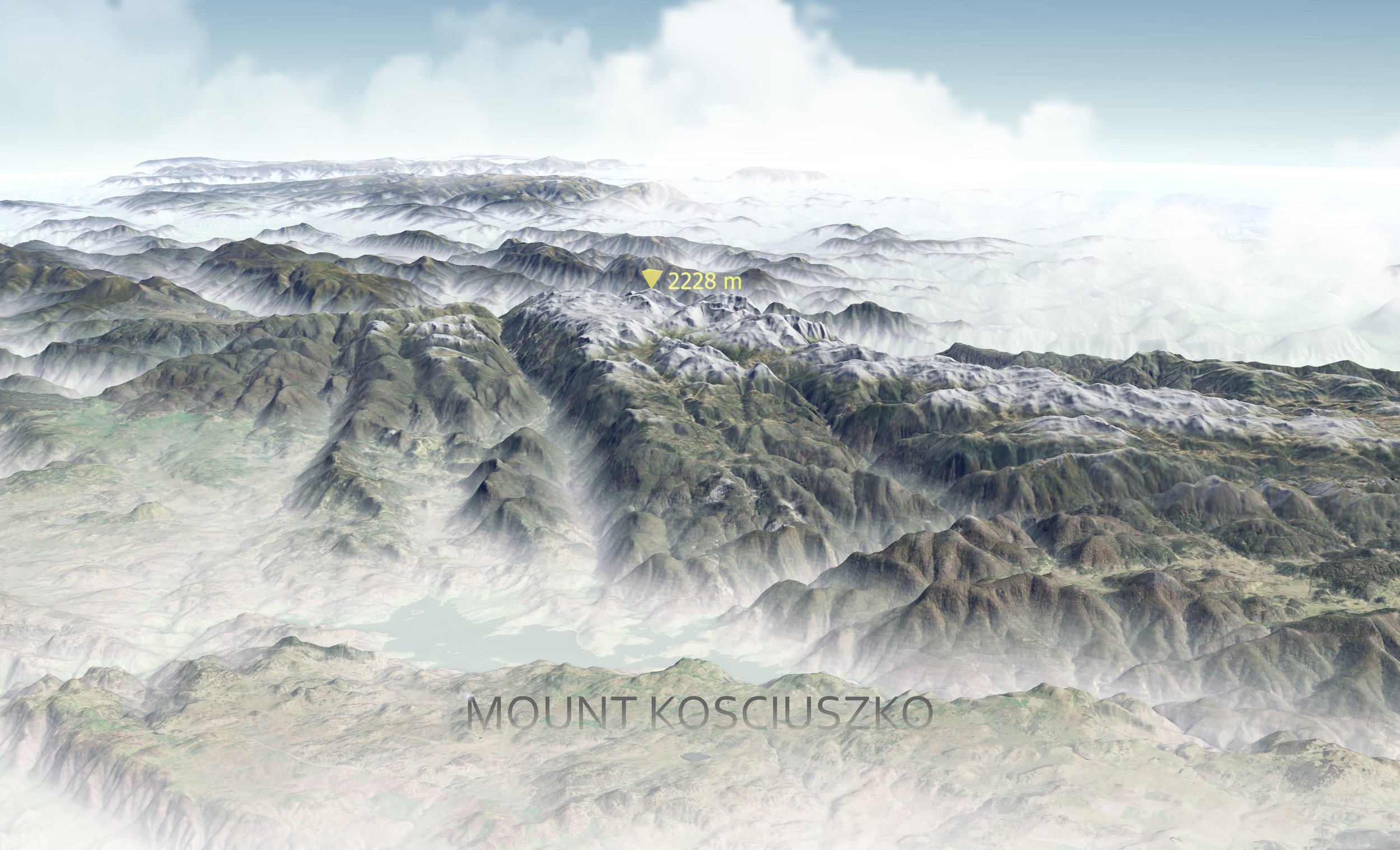
A 3D representation of Mount Kosciuszko using real data, and compiled in GIS software.
Sure, there is a wealth of possibilities in the graphic design suite. But in the hands of an expert cartographer, you’d be amazed at the possibilities from within GIS software. Not only can they produce stunning mapping, but it is often in a format that is instantly recogniseable and comfortable to digest as a map.
But if there is something you need from graphic design software, fear not. Maps produced by cartographers in GIS software can be 'finished’ in graphic design software too, to add that final aesthetic touch.
Basemap
Do your maps use imagery as a basemap? If you want any form of longevity out of your maps, then that is not a great idea. Not only does it muddy up a map with unnecessary noise, but it won’t be long before it is out of date and difficult to interpret. Think of what is around your area. Are there new subdivisions that will change? Agricultural land likely to change? Forest that may be burnt or harvested? Seasonal changes that impact the interpretation of natural features? If it is a long duration format like a sign, book or other print media, imagery is not a great idea.
Instead, opt for a custom basemap. Not only will it suit your needs based on the information you need to display, but can also be crafted to match your organisations branding and style. It is powerful when your map is recognisable as your brand. I mean, we all know Google Maps when we see it, don’t we?
Maximise the utility of your map
Let’s say you wanted a foldable map for your tourist information store and you have that produced. But later on you want a web map so that users can scan a QR code and check the availability of parking, or navigate using directions to a feature. If your cartographer created the map, those same layers can be utilised very swiftly in a web map doubling the utility of your data. This is not possible if your map was made from screen shots, or graphic designers.
Consider the following formats for your map:
Large format folded maps for four wheel driving or navigation.
Small format folded maps for hiking and cycling.
Interpretive signage and physical wayfinding.
Wall art for your office, visitor centre or public place.
Web and interactive maps for live data updates, or providing your visitors the flexibility to investigate the details that they are interested in.
If you created your first map project with a cartographer, you have left all of those doors open for future projects.
Go next level
What about a 3D map? We have prepared maps that show real life topography for display in tourist information and visitors centres. The very same data that was used to prepare the hard copy maps can then be used by 3D printers and CNC machines to create beautiful, tabletop displays.
Share the 3D map on the web and visitors can explore the scenery interactively.
A 3d map of Halls Gap, Victoria.
Check out our cartography page or click our social media links for more inspiration.